Fulfills:
BIOS 491/891 or NRES 498/898
Prerequisites:
BIOS 207, NRES 220, equivalent ecology course, or permission from instructor
About the Instructor:
Dr. Stella Uiterwaal - I am an ecologist in the GIS Lab at the Smithsonian Conservation Biology Institute's Conservation Ecology Center.
I am a former Senior Scientist with the Forest Park Living Lab, via the Living Earth Collaborative at Washington University in St. Louis researching the community movement ecology of wildlife in Forest Park, a spectacular park in the heart of St. Louis.
I completed my PhD in the DeLong lab at the University of Nebraska. My dissertation focused on predation in wolf spiders at Cedar Point Biological Station, and I have spent the last eight summers at Cedar Points learning, teaching, and conducting research. I'm particularly interested in why predators eat what they do and as much as they do, and how this depends on the predator's traits, community, and environment. I've worked with everything from protists to spiders to birds, although I have developed a particular fondness for owls.
Course Description:
This course will be especially valuable for students pursuing careers in wildlife biology or natural resources, those heading into graduate school or currently in graduate programs, and anyone preparing to meet the GIS and spatial analysis demands of modern ecological science and management. By blending ecological theory with hands-on spatial tools, the course equips students with the analytical and technical skills increasingly required across conservation, wildlife management, environmental consulting, and research careers.
This course is a mixture of lectures, field experiences, and computer work designed for students to:
- Develop an understanding of the ecological role of movement and its connection to other ecological processes
- Explore how landscape structure influences ecological patterns and processes.
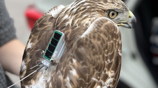
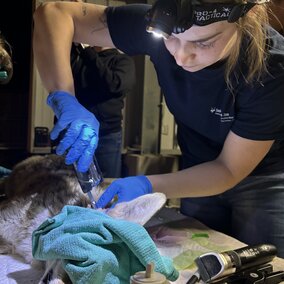
- Gain field experience collecting spatial data, including animal movement data.
- Build GIS analytical skills to visualize and interpret spatial data.
- Understand and apply animal movement analyses, including home range analyses, resource selection and step selection functions, and connectivity analyses.
- Create clear, effective maps using ecological data.
As part of this course, students will conduct an independent research project. Already have data? Bring it with you!
Students are not required to purchase a textbook or other materials. A laptop is required.
Ready to sign up for this class?
Head to our Marketplace page to pay your deposit which guarantees your seat in the class!