Cedar Point is located just east of the Kingsley Dam, on the south shore of Lake Ogallala. Our address is:
170 Cedar Point Drive, Rural Ogallala, NE 69153
You can print out the directions below or you can use Google Maps. NOTE: Google maps DOES NOT have detailed info about campus, only how to reach campus possibly from the back gate which will be locked. Please put in a secondary destination of Ogallala before the ending at CPBS. It will then route you the appropriate and easiest way.
The following is the easiest route to Cedar Point.
Directions/Maps
Written Directions
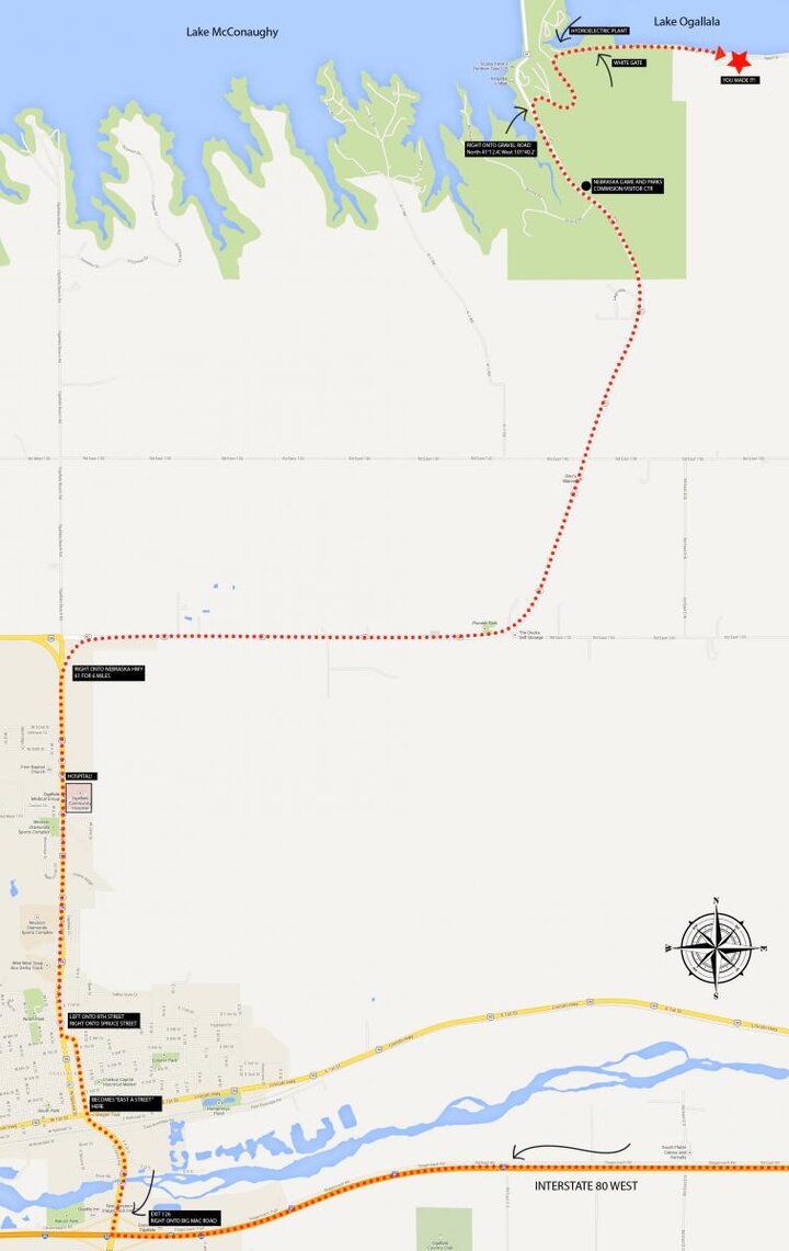
- Take Ogallala Exit 126 off Interstate-80 WEST.
- Turn right onto Big Mac Road (aka: U.S.26/Nebr. 61)
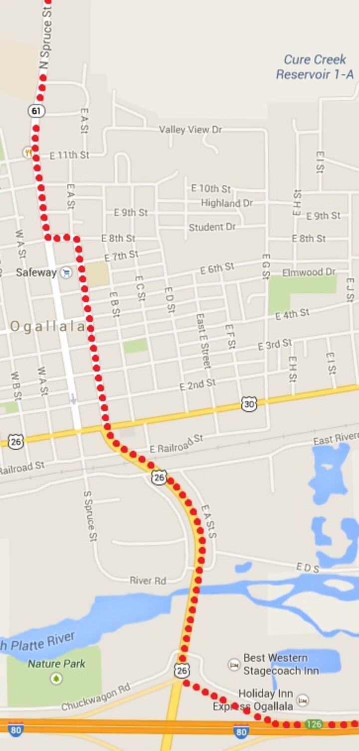
- Follow U.S.26/Nebr. 61 through Ogallala for approximately 3 miles (follow the signs for Lake McConaughy). U.S.26/Nebr. 61 becomes East A Street once you cross Lincoln Hwy. Continue on East A St. through town, staying in the left lane.
- Turn left onto 8th Street.
- Go one block, turn right on N Spruce Street.
- Continue north out of town.
- A short distance past the hospital, the highways split. Keep right on Neb. Highway 61 for approximately 6 miles.
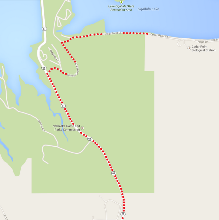
- As you approach Kingsley Dam (Lake McConaughy will be visible ahead to your left) there will be a Nebraska Game and Parks visitor center on your right.
- At 0.6 miles north of the visitor center, you will crest a hill. Turn right onto the gravel road (GPS coordinates: North 41°12.4’, West 101°40.2’). Follow this winding road down towards the hydroelectric plant.
- At the fork near the plant, keep right. You will come across a white gate labeled “Cedar Point Biological Station.” The gate is chained but not locked.
- After passing through, close and secure the gate behind you
- Continue driving for approximately 3/4 mile. To the left of the road is a large area facing the lake; park here. CP campus will be behind you.
- On foot, continue down the road you came in on (east) until you encounter a UNL sign and a gravel drive.
- Turn right onto the drive; it will lead you to the loading dock and cement steps. Go up the steps; you will be on the south side of Goodall Lodge. Just to the east of Goodall Lodge is the Gainsforth Resource Center where you will check in at the office.
Map Depiction
Detailed Ogallala Map
Detailed CPBS Turn In Map